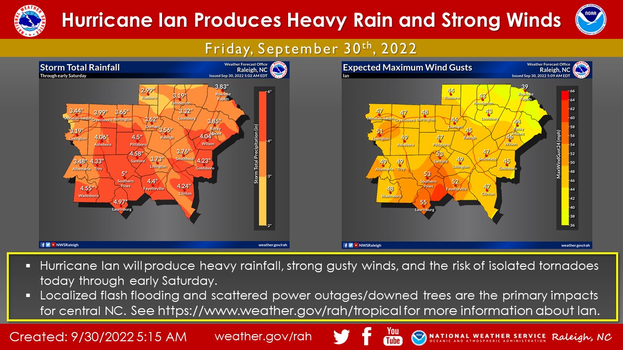
As of 11 am, The National Weather Service says the center of Hurricane Ian is located 60 miles east-southeast of Charleston, SC, and continues to push rain bands up through central NC. Expect rainfall intensity and maximum winds to continue to increase as Ian’s circulation moves into NC later this evening.
Ian is moving toward the north near 14 mph (22 km/h). Ian is forecast to move more quickly toward the north today followed by a turn toward the north-northwest by tonight. On the forecast track, the center of
Ian will reach the coast of South Carolina today and then move farther inland across eastern South Carolina and central North Carolina tonight and Saturday.
Maximum sustained winds remain near 85 mph (140 km/h) with higher gusts. Ian should maintain about the same strength before landfall later, then weaken and rapidly transition into a post-tropical cyclone overnight. Ian should dissipate over western North Carolina or Virginia late Saturday.
Hurricane-force winds extend outward up to 70 miles (110 km) from the center and tropical-storm-force winds extend outward up to 275 miles (445 km). A sustained wind of 62 mph (100 km/h) and a gust to
87 mph (140 km/h) was recently reported at an elevated WeatherFlow station on Winyah Bay Range in South Carolina.

