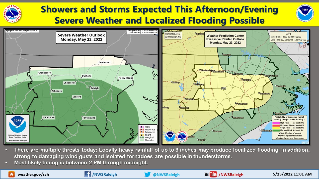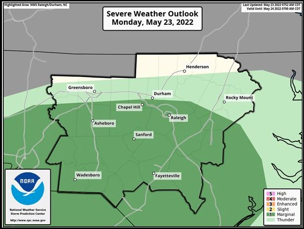
(NCNN WeatherCenter)–Much of central North Carolina is under a Level 1 risk for severe weather on Monday at the start of a wet pattern for this week.
It will be a milder day, with temperatures topping out in the upper 70s. The first half of the day will be dry, but NCNN meteorologist Aimee Wilmoth said the storms are possible anytime this afternoon and evening, with the first wave most likely arriving between 4 p.m. and 7 p.m. Wind damage and heavy downpours are possible, especially south and west of the Triangle.
On Monday afternoon, tornado warnings were issued in the Triad area in Montgomery, Davidson and Randolph counties.
Damaging winds and hail will be the main threats for Monday’s severe storms risk. The risk area covers the Triangle and points south and carries a medium risk for flash flooding.
Even after the stronger storms move out of our area, rain showers and isolated storms could linger overnight and into Tuesday morning. A second round of storms could move in between 9 p.m. and midnight. By Monday night, some areas of central North Carolina could see upwards of two inches of rain.
After a mild Monday, even cooler temperatures will arrive for Tuesday. Tuesday will feature a high of 73 degrees and some showers possible in counties south of Wake County mostly in the morning hours.
On Tuesday, Johnston, Wayne and Wilson counties are part of a Level 1 severe risk that extends to most of eastern North Carolina.
“Showers look more likely for Tuesday morning’s commute,” said NCNN meteorologist Zach Maloch. “We are looking at generally lighter rain shower activity for Tuesday afternoon.”
Wednesday will be drier and warmer with a high around 80 degrees, “Showers look more likely for Tuesday morning’s commute,” said NCNN meteorologist Zach Maloch. “We are looking at generally lighter rain shower activity for Tuesday afternoon.”
Next weekend appears to be the driest portion of the week, with highs in the 80s. Temperatures will heat back up and reach a high of 83 degrees on Friday.