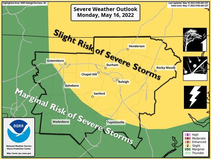
(NCNN WeatherCenter)–Much of the state is under a Level 2 risk for severe weather today. Damaging winds, hail, heavy rain and isolated tornadoes are all possible.
The risk for severe weather will be greater for northern and eastern counties, NCNN WeatherCenter meteorologist Elizabeth Gardner said. The greatest threat for tornadoes will be close to the Virginia line.
Severe weather may not begin until during or after the evening commute, although storms are possible after 4 p.m.
NCNN WeatherCenter meteorologist Aimee Wilmoth said northwestern counties will see storms first, then on-and-off storms will be likely in the Triangle by 6 p.m. At 7:30 p.m., the worst of the storms should be just northeast of the Triangle, and storms are expected to move away from North Carolina after 9 or 10 p.m.
The storms will arrive with a cold front, but that doesn’t mean the next few days will be cool.
“The front doesn’t do much to our temperatures, but it does help to drop our humidity levels tomorrow and Wednesday,” Wilmoth said.
Highs will be in the mid to upper 80s Tuesday and Wednesday, which will be dry.
Later this week, we’ll get a taste of summer, with our first 90 degree day likely on Thursday. There will also be a chance of rain Thursday.
The weekend is looking even warmer, with highs in the mid 90s for Friday and Saturday and a chance for rain Sunday.


